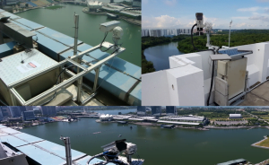
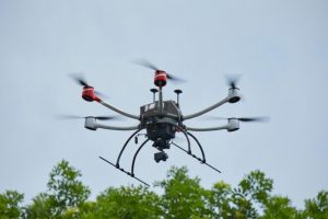
Water quality parameters are usually obtained using in-situ sensor probes or by laboratory measurements of water samples collected on site. These conventional methods are laborious and costly, and have limited spatial coverage. Remote sensing can complement in-situ measurements with advantages of wide spatial and repetitive temporal coverage. Using remote sensing, maps showing the spatial distribution of water quality parameters can be produced at multiple time intervals for monitoring purposes. Remote sensing data can be acquired by sensors carried on satellites, as well as air-borne or ground-based platforms. In this project the implementation of near real-time area-monitoring and mapping of inland and reservoir water quality was explored using a ground-based remote sensing system. The principle and methods employed are similar to satellite imaging, and the water body naturally illuminated by sun- and/or sky-light.